Original: $13,995.00
-65%$13,995.00
$4,898.25The Story
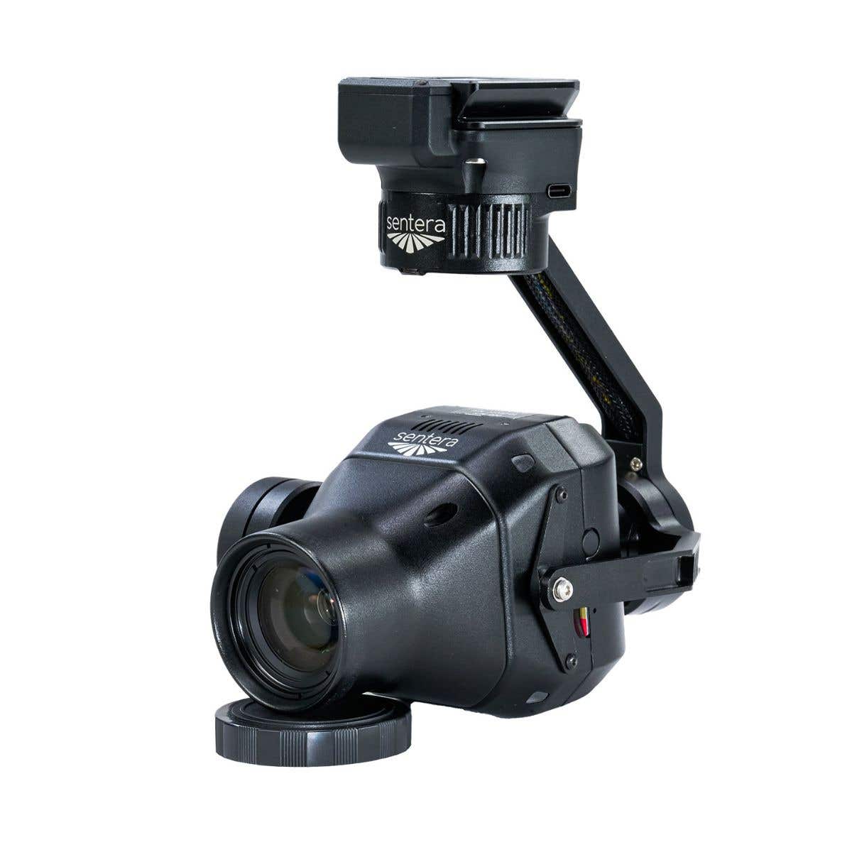
Freefly Flux L1: 450 m Range LiDAR Payload With Non-Repetitive Scanning for Power Line and Forestry Missions
The Freefly Flux L1 brings professional airborne LiDAR within reach for operators who need extended range and non-repetitive scanning coverage without the complexity or cost structure of top-tier systems.
Powered by the Livox Avia scanner, it delivers 720,000 points per second across a 70°×77° field of view at ranges up to 450 m (1,476 ft), with a non-repetitive scanning pattern that continuously varies beam direction to ensure complete coverage of fine or complex targets like power lines, forest canopy, and hard-to-map structural assets that conventional repetitive scanners routinely miss.
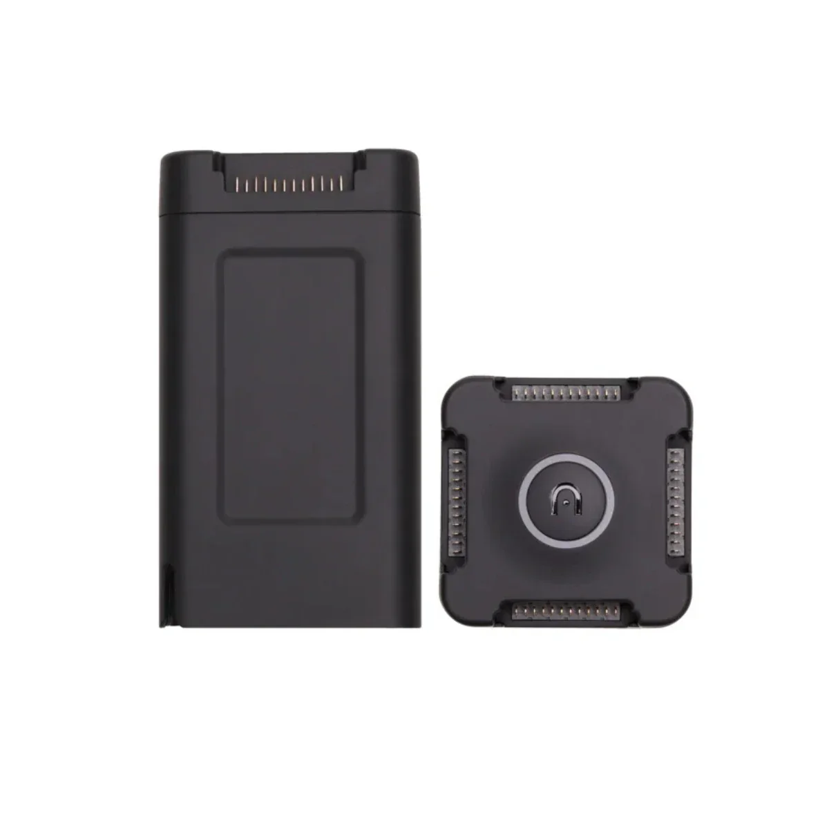
At 715 grams with an integrated Smart Dovetail mount, it connects directly to the Freefly Astro, Astro Max, and Alta X Gen2, and outputs to LAS or LAZ through the free Freefly Flow iPad app with no software subscription at any stage of the workflow.
Key Features and Benefits
- Livox Avia scanner: 720,000 points per second at ranges up to 450 m (1,476 ft).
- 70°×77° field of view: non-repetitive pattern ensures complete detection of complex targets.
- ±5 cm accuracy: 2 cm precision for professional-grade georeferenced 3D data.
- Three laser returns: additional fidelity through canopy, layered surfaces, and obstructed geometry.
- 450 m range: supports efficient coverage at higher flight altitudes across large survey areas.
- Dual U-blox X20 GNSS: full-band L1/L2/L5/L6 receivers for accurate PPK post-processing.
- Ximea 20MP RGB camera: produces colorized point clouds in a single flight pass.
- 715 g form factor: compact and optimized for long endurance flights on Freefly platforms.
- Smart Dovetail interface: direct tool-free integration with Astro, Astro Max, and Alta X Gen2.
- LAS and LAZ export: standard output formats with no subscription or licensing cost.
Where the Flux L1 separates itself from comparable payloads is in the combination of 450 m range and non-repetitive scanning in a single deployable package. Three laser returns (one more than many payloads in its class) provide additional data fidelity through layered canopy, partially obstructed infrastructure, and complex surface geometries.
The dual U-blox X20 full-band GNSS receivers handle PPK correction across L1, L2, L5, and L6, and the integrated Ximea 20MP RGB camera colorizes the point cloud in the same pass.
For fleet operators running Freefly aircraft on power line inspections, forestry programs, and large-area terrain surveys, the L1 is a payload that was designed for the missions where range and scanning pattern matter more than raw point density and delivers both without adding software overhead to the operational cost structure.
Non-Repetitive Scanning at 450 m. Built for the Missions That Demand It
The Flux L1's design priority is legible in its spec sheet: 450 m range and a non-repetitive scanning pattern address a specific set of missions where conventional rotating LiDAR falls short. Power line corridors, where conductors may be only a few centimeters in diameter, require a scanner that doesn't repeat the same gap on every revolution.
Forest surveys, where ground point extraction depends on pulses finding gaps in the canopy across multiple passes, benefit from the increasing coverage density that non-repetitive scanning accumulates with dwell time. And at 450 m, the L1 operates at altitudes where coverage efficiency improves substantially: fewer flight lines, longer transects, and more area covered per battery.
Three laser returns further extend data quality through layered or partially obstructed surfaces, and the zero-subscription Flow app workflow ensures that the per-mission cost stays fixed at what it costs to fly.
Freefly Flux LiDAR Payload Comparison
| Category | Flux O1 | Flux L1 | Flux H1 |
|---|---|---|---|
| Scanner | Ouster OS1 | Livox Avia | Hesai XT-32MX |
| Points / sec | 5,242,880 | 720,000 | 1,920,000 |
| Range | ~200 m | 450 m | 300 m |
| Field of view | 360° × 42.4° | 70° × 77° | 360° × 40.3° |
| Accuracy | ±3 cm | ±5 cm | ±1 cm |
| Precision | 0.5 cm | 2 cm | 0.5 cm |
| Laser returns | 2 | 3 | 3 |
| Weight | 633 g | 715 g | 715 g |
| Scan pattern | Repetitive | Non-repetitive | Repetitive |
| NDAA | Yes | No | No |
| RGB camera | Ximea 20MP | Ximea 20MP | Ximea 20MP |
Compatibility and System Integration
- Freefly Astro: native Smart Dovetail integration; GNSS mounts included in box.
- Freefly Astro Max: native Smart Dovetail integration; GNSS mounts included in box.
- Freefly Alta X Gen2: compatible with separately sold Freefly GNSS Mount.
- Freefly Flow app: free post-processing app for Apple M-Series iPads; no subscription required.
- Full-band GNSS base station: L1, L2, L5, and L6 required; dual-band will not work.
- NTRIP service: full-band equivalent accepted as base station alternative.
- LAS/LAZ output: compatible with survey, GIS, forestry, and infrastructure software platforms.
Applications and Use Cases
- Power line and corridor inspection: non-repetitive scanning detects fine conductors at extended range.
- Forestry and vegetation analysis: 450 m range and three returns extract ground points through dense canopy.
- Large-area terrain and topographic mapping: extended range supports efficient high-altitude coverage.
- Hard-to-map asset documentation: variable beam direction captures targets repetitive scanners miss.
- Infrastructure and structural inspection: complete FOV coverage resolves complex geometry in fewer passes.
- Utility and pipeline corridor surveys: 450 m range covers linear assets with fewer required flight lines.
- Construction and earthwork monitoring: ±5 cm accuracy supports volumetric and progress tracking workflows.
The Flux L1 addresses a persistent gap in the airborne LiDAR market for Freefly platform operators: a long-range, non-repetitive scanning payload that integrates natively with the Smart Dovetail ecosystem, processes data through a free app, and doesn't add software licensing to the mission cost.
For teams running power line inspections, forestry surveys, and large-area mapping programs on Freefly aircraft, it delivers the scanning characteristics those missions require in a form factor that fits the platform they already operate.
Dronefly specializes in matching the right sensor to the right platform for enterprise survey and inspection programs, and the Freefly Flux L1 is the payload that Freefly ecosystem operators have been waiting for when range and scanning pattern are the mission priorities. When you source the Flux L1 through Dronefly, you get the configuration expertise to pair it correctly with your aircraft, base station, and post-processing setup.
Reach out to Dronefly today to discuss your project requirements and place your order.

Details & Craftsmanship
Every detail has been carefully considered to bring you the perfect product.

Details & Craftsmanship
Every detail has been carefully considered to bring you the perfect product.
Description
Freefly Flux L1: 450 m Range LiDAR Payload With Non-Repetitive Scanning for Power Line and Forestry Missions
The Freefly Flux L1 brings professional airborne LiDAR within reach for operators who need extended range and non-repetitive scanning coverage without the complexity or cost structure of top-tier systems.
Powered by the Livox Avia scanner, it delivers 720,000 points per second across a 70°×77° field of view at ranges up to 450 m (1,476 ft), with a non-repetitive scanning pattern that continuously varies beam direction to ensure complete coverage of fine or complex targets like power lines, forest canopy, and hard-to-map structural assets that conventional repetitive scanners routinely miss.
At 715 grams with an integrated Smart Dovetail mount, it connects directly to the Freefly Astro, Astro Max, and Alta X Gen2, and outputs to LAS or LAZ through the free Freefly Flow iPad app with no software subscription at any stage of the workflow.
Key Features and Benefits
- Livox Avia scanner: 720,000 points per second at ranges up to 450 m (1,476 ft).
- 70°×77° field of view: non-repetitive pattern ensures complete detection of complex targets.
- ±5 cm accuracy: 2 cm precision for professional-grade georeferenced 3D data.
- Three laser returns: additional fidelity through canopy, layered surfaces, and obstructed geometry.
- 450 m range: supports efficient coverage at higher flight altitudes across large survey areas.
- Dual U-blox X20 GNSS: full-band L1/L2/L5/L6 receivers for accurate PPK post-processing.
- Ximea 20MP RGB camera: produces colorized point clouds in a single flight pass.
- 715 g form factor: compact and optimized for long endurance flights on Freefly platforms.
- Smart Dovetail interface: direct tool-free integration with Astro, Astro Max, and Alta X Gen2.
- LAS and LAZ export: standard output formats with no subscription or licensing cost.
Where the Flux L1 separates itself from comparable payloads is in the combination of 450 m range and non-repetitive scanning in a single deployable package. Three laser returns (one more than many payloads in its class) provide additional data fidelity through layered canopy, partially obstructed infrastructure, and complex surface geometries.
The dual U-blox X20 full-band GNSS receivers handle PPK correction across L1, L2, L5, and L6, and the integrated Ximea 20MP RGB camera colorizes the point cloud in the same pass.
For fleet operators running Freefly aircraft on power line inspections, forestry programs, and large-area terrain surveys, the L1 is a payload that was designed for the missions where range and scanning pattern matter more than raw point density and delivers both without adding software overhead to the operational cost structure.
Non-Repetitive Scanning at 450 m. Built for the Missions That Demand It
The Flux L1's design priority is legible in its spec sheet: 450 m range and a non-repetitive scanning pattern address a specific set of missions where conventional rotating LiDAR falls short. Power line corridors, where conductors may be only a few centimeters in diameter, require a scanner that doesn't repeat the same gap on every revolution.
Forest surveys, where ground point extraction depends on pulses finding gaps in the canopy across multiple passes, benefit from the increasing coverage density that non-repetitive scanning accumulates with dwell time. And at 450 m, the L1 operates at altitudes where coverage efficiency improves substantially: fewer flight lines, longer transects, and more area covered per battery.
Three laser returns further extend data quality through layered or partially obstructed surfaces, and the zero-subscription Flow app workflow ensures that the per-mission cost stays fixed at what it costs to fly.
Freefly Flux LiDAR Payload Comparison
| Category | Flux O1 | Flux L1 | Flux H1 |
|---|---|---|---|
| Scanner | Ouster OS1 | Livox Avia | Hesai XT-32MX |
| Points / sec | 5,242,880 | 720,000 | 1,920,000 |
| Range | ~200 m | 450 m | 300 m |
| Field of view | 360° × 42.4° | 70° × 77° | 360° × 40.3° |
| Accuracy | ±3 cm | ±5 cm | ±1 cm |
| Precision | 0.5 cm | 2 cm | 0.5 cm |
| Laser returns | 2 | 3 | 3 |
| Weight | 633 g | 715 g | 715 g |
| Scan pattern | Repetitive | Non-repetitive | Repetitive |
| NDAA | Yes | No | No |
| RGB camera | Ximea 20MP | Ximea 20MP | Ximea 20MP |
Compatibility and System Integration
- Freefly Astro: native Smart Dovetail integration; GNSS mounts included in box.
- Freefly Astro Max: native Smart Dovetail integration; GNSS mounts included in box.
- Freefly Alta X Gen2: compatible with separately sold Freefly GNSS Mount.
- Freefly Flow app: free post-processing app for Apple M-Series iPads; no subscription required.
- Full-band GNSS base station: L1, L2, L5, and L6 required; dual-band will not work.
- NTRIP service: full-band equivalent accepted as base station alternative.
- LAS/LAZ output: compatible with survey, GIS, forestry, and infrastructure software platforms.
Applications and Use Cases
- Power line and corridor inspection: non-repetitive scanning detects fine conductors at extended range.
- Forestry and vegetation analysis: 450 m range and three returns extract ground points through dense canopy.
- Large-area terrain and topographic mapping: extended range supports efficient high-altitude coverage.
- Hard-to-map asset documentation: variable beam direction captures targets repetitive scanners miss.
- Infrastructure and structural inspection: complete FOV coverage resolves complex geometry in fewer passes.
- Utility and pipeline corridor surveys: 450 m range covers linear assets with fewer required flight lines.
- Construction and earthwork monitoring: ±5 cm accuracy supports volumetric and progress tracking workflows.
The Flux L1 addresses a persistent gap in the airborne LiDAR market for Freefly platform operators: a long-range, non-repetitive scanning payload that integrates natively with the Smart Dovetail ecosystem, processes data through a free app, and doesn't add software licensing to the mission cost.
For teams running power line inspections, forestry surveys, and large-area mapping programs on Freefly aircraft, it delivers the scanning characteristics those missions require in a form factor that fits the platform they already operate.
Dronefly specializes in matching the right sensor to the right platform for enterprise survey and inspection programs, and the Freefly Flux L1 is the payload that Freefly ecosystem operators have been waiting for when range and scanning pattern are the mission priorities. When you source the Flux L1 through Dronefly, you get the configuration expertise to pair it correctly with your aircraft, base station, and post-processing setup.
Reach out to Dronefly today to discuss your project requirements and place your order.